Log in
All resources
Create a design
5,876 Free Artworks of Image Map
maps in the library of congress
description de l'universe
alain manesson mallet
maps from the earth and its inhabitants, vol. iv
baroque
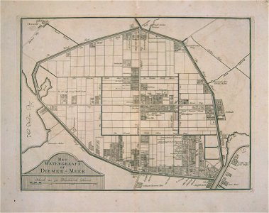
atlas schoemaker-noord-holland, amsterdam
maps of polders in north holland
royal dutch antiquarian society
1685 maps of europe
maps from the earth and its inhabitants, vol. xiv
maps from traité de la police, bibliothèque nationale de france
first map of paris from traité de la police
kaart figuratief delft, tweede staat
collections of stadsarchief delft
maps in the library of congress
1639 maps of the caribbean
maps in the biblioteca nacional do brasil
1587 maps
atlas schoemaker-noord-holland, amsterdam
history of diemen
gemeente atlas van nederland - gelderland
maps in the library of congress
1792 maps of africa
description de l'universe
1680s maps of england
historical images of the hôtel de lassay
historical images of palais bourbon
old images of dadra and nagar haveli and daman and diu
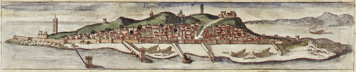
maps of diu by braun & hogenberg
old images of dadra and nagar haveli and daman and diu
maps of diu by braun & hogenberg
maps in the library of congress
1876 maps of pennsylvania
degas (crater)
impressionism
maps in the library of congress
bird's eye view maps of indiana
maps of archaeological sites in italy
storia degli antichi popoli italiani
maps from the earth and its inhabitants, vol. xiv
maps of the sunda strait
maps in the library of congress
1889 maps of new york (state)
maps in the library of congress
1863 maps
new york and brooklyn, with jersey city and hoboken water front
maps in the library of congress
maps in the library of congress
1889 maps of new york (state)
maps from the earth and its inhabitants, vol. iv
topographic maps of ireland
maps from the earth and its inhabitants, vol. ix
maps of south india
maps from the earth and its inhabitants, vol. iv
linguistic maps of the united kingdom
maps from the earth and its inhabitants, vol. xi
19th-century maps of chad
maps of weather and climate of the united kingdom
maps from the earth and its inhabitants, vol. iv
maps from the earth and its inhabitants, vol. xvii
maps of u.s. water resource subbasins
maps from the earth and its inhabitants, vol. xiv
1870s maps of new zealand
plan de roussel - derivative files
maps of the bois de boulogne
bibliothèque municipale de reims, rès. g 153
historical images of valence (drôme)
clifton (bristol ward)
old maps of clifton
clifton (bristol ward)
old maps of clifton
turgot map of paris, david rumsey historical map collection – derivative files
historical images of the hôtel des invalides
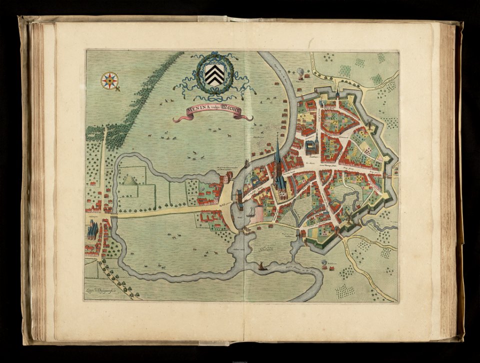
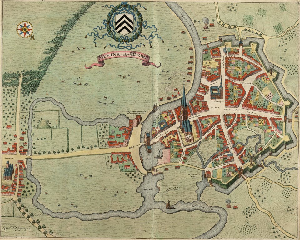
flandria illustrata
old maps of menen
orbispictus - extracted images
1650s maps of the world
maps in the library of congress
1785 maps
maps in the library of congress
1851 maps of new york (state)
maps in the library of congress
1768 maps of north america
maps in the library of congress
pont-aven school
17th-century maps of puerto rico
description de l'universe
tremper mound and earthworks
squier and davis images
zehn karten und ansichten den schlachtfelden des amerikanischen unabhängigkeitskreiges in den staaten pennsylvanien und new york
maps in the library of congress
zehn karten und ansichten den schlachtfelden des amerikanischen unabhängigkeitskreiges in den staaten pennsylvanien und new york
maps in the library of congress
maps of paris in the 1630s
baroque
maps in the library of congress
1776 maps of new jersey
maps in the library of congress
1776 maps of new jersey
historical images of église saint-nicolas-du-chardonnet
map of paris by braun & hogenberg - derivative files
maps in the library of congress
1758 maps of cuba
turgot map of paris, david rumsey historical map collection – derivative files
historical images of bièvre river in paris
maps of the palatinate of the rhine
1692 maps of rhineland-palatinate
naturalism,realism
maps of venus
maps from the earth and its inhabitants, vol. iv
maps of lewis, scotland
maps from the earth and its inhabitants, vol. ix
exploration of arabia
maps in the library of congress
1866 maps of pennsylvania
1840s maps of the world
german renaissance
latin-language maps
german renaissance
historical images of abbaye de saint-germain-des-prés
foire saint-germain on old maps
engravings of topographia austriacarum
baroque
flandria illustrata
old maps of menen
a school geography (1898) by bird
old maps of the yellow sea
description de l'universe
old maps of newfoundland
prints of cartouches in the rijksmuseum amsterdam
maps in the rijksmuseum amsterdam
topographia bohemiae moraviae et silesiae (merian)
baroque
hôtel du petit-bourbon
old submaps of paris
bek (crater)
romanticism
maps in the library of congress
1734 maps of north america
maps of switzerland by johann jakob scheuchzer
1712 maps
the comprehensive history of england (1876)
english-language maps showing history
maps in the library of congress
old maps of new jersey
atlas schoemaker-noord-holland, amsterdam
old maps of diemen
atlas schoemaker-noord-holland, amsterdam
old maps of amsterdam
lord burghley's atlas (1579) - bl royal ms 18 d iii
maps of wales by humphrey llwyd
merian mainz trier köln
baroque
the comprehensive history of england (1876)
english-language maps showing history
redeeming the republic (1890)
1890s maps showing history
old maps of saint-louis (senegal)
orientalist painting
old maps of saint-louis (senegal)
orientalist painting
maps in the library of congress
1750s maps of the caribbean
the history and antiquities of the parish of lambeth, and the archiepiscopal palace (1827)
1820s maps of london
maps in the library of congress
birds-eye view of seattle, 1884
maps of haussmann's renovation of paris
rue de médicis (paris)
maps of haussmann's renovation of paris
rue de médicis (paris)
maps in the library of congress
1718 maps
maps from the earth and its inhabitants, vol. xii
1710s maps of africa
wanderings, south and east (1882)
old maps of polynesia
maps from the earth and its inhabitants, vol. iv
linguistic maps of wales
maps from the earth and its inhabitants, vol. vii
floods in china
maps from the earth and its inhabitants, vol. v
maps of sea ice
ismailïa. a narrative of the expedition to central africa for the suppression of the slave trade (1874)
1874 maps of africa
maps from the earth and its inhabitants, vol. xiii
maps of orange free state
maps from the earth and its inhabitants, vol. xiv
19th-century maps of borneo
old maps of the bering sea
old maps of kamchatka
scrambles amongst the alps
massif de la meije
historical images of palais des princes-evêques de liège
maps by willem and johannes blaeu
turgot map of paris, kyoto university library – derivative files
foire saint-germain on old maps
description de l'universe
old maps of patmos
description de l'universe
1680s maps of germany
description de l'universe
1680s maps of ireland
maps from the earth and its inhabitants, vol. xiii
exploration of africa
maps from the earth and its inhabitants, vol. x
1910s maps of somalia
old maps of south africa
maps of transvaal
401 - 500 of 5,876
Next page
/ 59

![[Map of the islands of Hispaniola and Puerto Rico]., Johannes Vingboons, 1639](https://cdn.creazilla.com/illustrations/6627413/map-of-the-islands-of-hispaniola-and-puerto-rico-loc-2003623402-illustration-md.jpeg)